Skip to content
Weather.JayCTheriot.Com

Weather.JayCTheriot.Com

Be Wise. Be Safe. Be Informed

  • Home
    • Purpose and Scope
    • Glossary
    • Coastal Weather Anomaly Advance Detection System (CWAADS)
      • Multi-dimensional reduction of systemic error in data analysis specific to coastal weather anomalies as data from buoys dictate
      • Coastal Weather Anomaly Advance Detection System (CWAADS)
      • GoM Buoy Data Feeds
      • ToDo
  • Theaters
    • NHC Gulf of Mexico Information
    • Atlantic
    • NOAA Gulf of Mexico Imagery
    • Atlantic Watch
    • Central Pacific
    • Eastern Pacific
    • Caribbean
    • Atlantic
  • Gulf of Mexico
    • Northern Gulf Coast Current Conditions
    • SELA Current Info
    • Global Buoys and Storm Overlays
    • Gulf of Mexico
    • Gulf of Mexico and US Mainland Conditions
  • Blog
  • Toggle search form

Category: Cold Front

Wed., Dec. 14, 2022 – Heavy Weather Approaching

Posted on December 14, 2022December 14, 2022 By Jazzy J No Comments on Wed., Dec. 14, 2022 – Heavy Weather Approaching
Wed., Dec. 14, 2022 – Heavy Weather Approaching

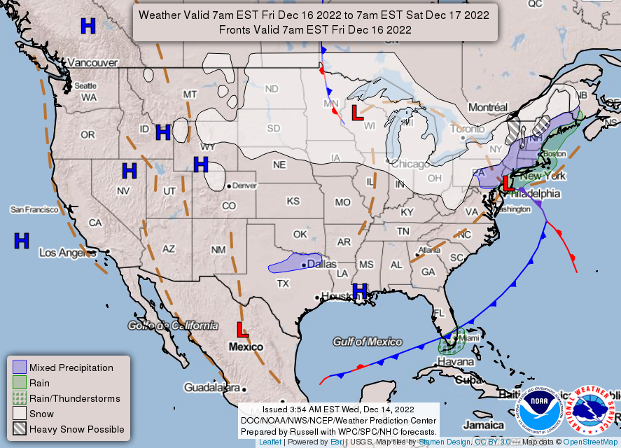
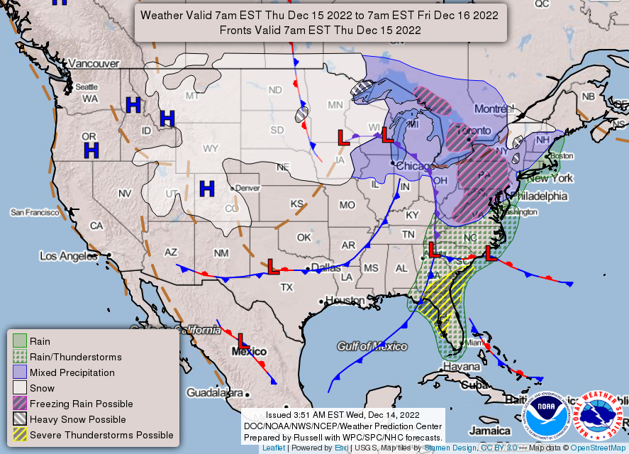
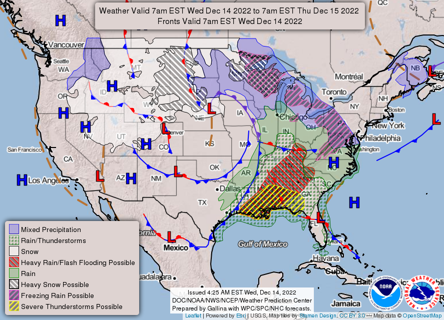
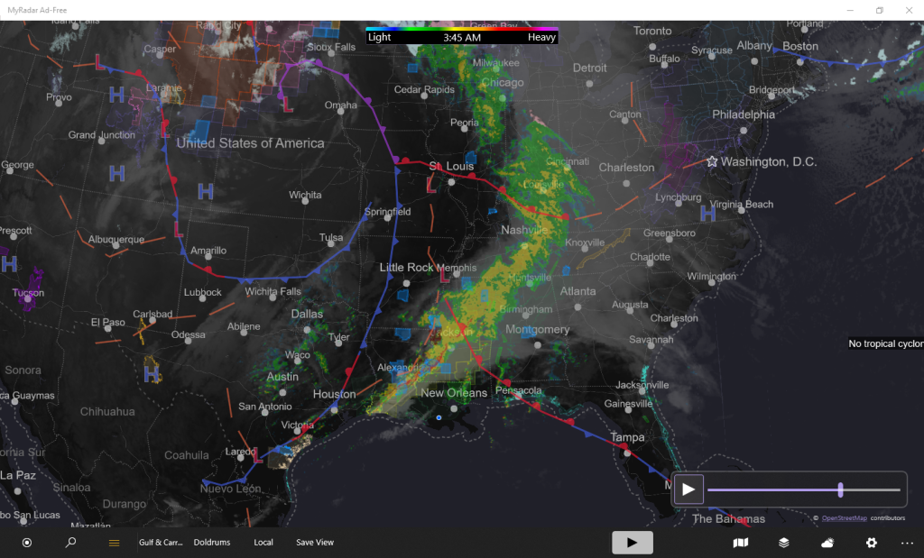
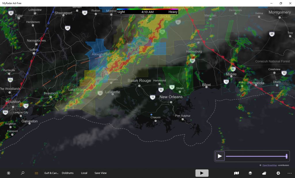
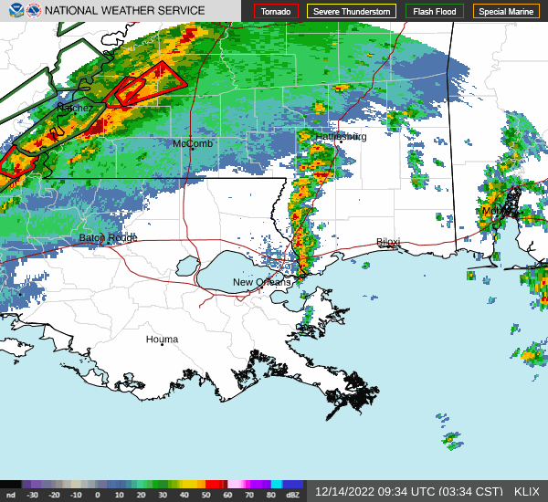
Flood Watch for a good portion of Southeast Louisiana (SELA).

From Weather.Gov:

Wednesday: Showers and thunderstorms before 3pm, then showers and possibly a thunderstorm between 3pm and 5pm, then showers and thunderstorms likely after 5pm. Some storms could be severe, with heavy rain. Temperature rising to near 76 by 10am, then falling to around 69 during the remainder of the day. Breezy, with a south wind 15 to 20 mph becoming west in the afternoon. Winds could gust as high as 30 mph. Chance of precipitation is 100%. New rainfall amounts between three quarters and one inch possible.

Cold Front, Flooding, General Weather, Thumderstorms

Posts navigation

Previous 1 2 3

Copyright © 2007-2023 Jay C. Theriot, all rights reserved.

Powered by Pressbook modified for Weather.JayCTheriot.Com WordPress theme