
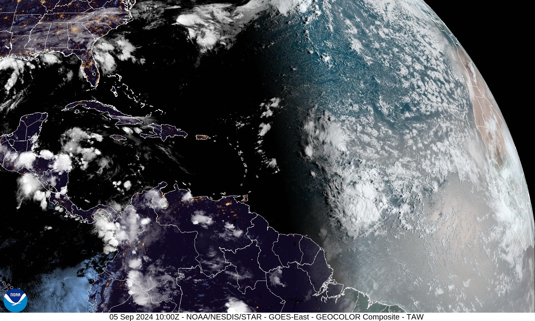
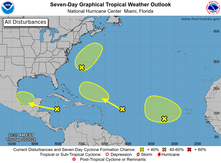
Whooo. A lot out there, but nothing immediately threatening. Info from the NHC below the graphic.
ZCZC MIATWOAT ALL
TTAA00 KNHC DDHHMM

Tropical Weather Outlook
NWS National Hurricane Center Miami FL
200 AM EDT Thu Sep 5 2024

For the North Atlantic...Caribbean Sea and the Gulf of Mexico:

1. Northwestern Atlantic:
A non-tropical area of low pressure located a few hundred miles east of North Carolina is producing limited shower and thunderstorm activity well to the east of its center. This system could acquire some subtropical characteristics over the next couple of days or so while it moves generally north-northeastward, remaining offshore of the northeastern United States. Once the low moves over cooler waters by late Saturday, further subtropical development is not expected. Additional information on this system, including gale warnings, can be found in High Seas Forecasts issued by the National Weather Service.
* Formation chance through 48 hours...low...10 percent.
* Formation chance through 7 days...low...20 percent.

2. Eastern Tropical Atlantic:
A broad area of low pressure over the eastern tropical Atlantic is producing disorganized showers and thunderstorms. Some slow development of this system is possible during the next several days while it drifts northwestward or northward.
* Formation chance through 48 hours...low...10 percent.
* Formation chance through 7 days...low...20 percent.

3. Northwestern Caribbean Sea and Southwestern Gulf of Mexico:
A tropical wave moving quickly westward at about 20 mph over the western Caribbean Sea continues to produce a broad area of disorganized showers and thunderstorms. Some development is possible in a few days after the system crosses the Yucatan Peninsula of Mexico and moves over the southwestern Gulf of Mexico.
* Formation chance through 48 hours...low...near 0 percent.
* Formation chance through 7 days...low...30 percent.

4. Central Tropical Atlantic:
Another tropical wave located several hundred miles east of the Lesser Antilles is producing disorganized shower and thunderstorm activity. Strong upper-level winds are expected to limit development of this system during the next few days while it moves west-northwestward at 10 to 15 mph. By early next week, environmental conditions could become more conducive for some slow development while the system moves northwestward over the southwestern Atlantic Ocean.
* Formation chance through 48 hours...low...near 0 percent.
* Formation chance through 7 days...low...10 percent.


High Seas Forecasts are issued by the National Weather Service under AWIPS header NFDHSFAT1 and WMO header FZNT01 KWBC, and online at ocean.weather.gov/shtml/NFDHSFAT1.php

Forecaster Reinhart