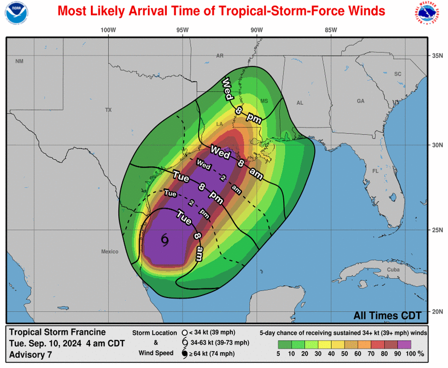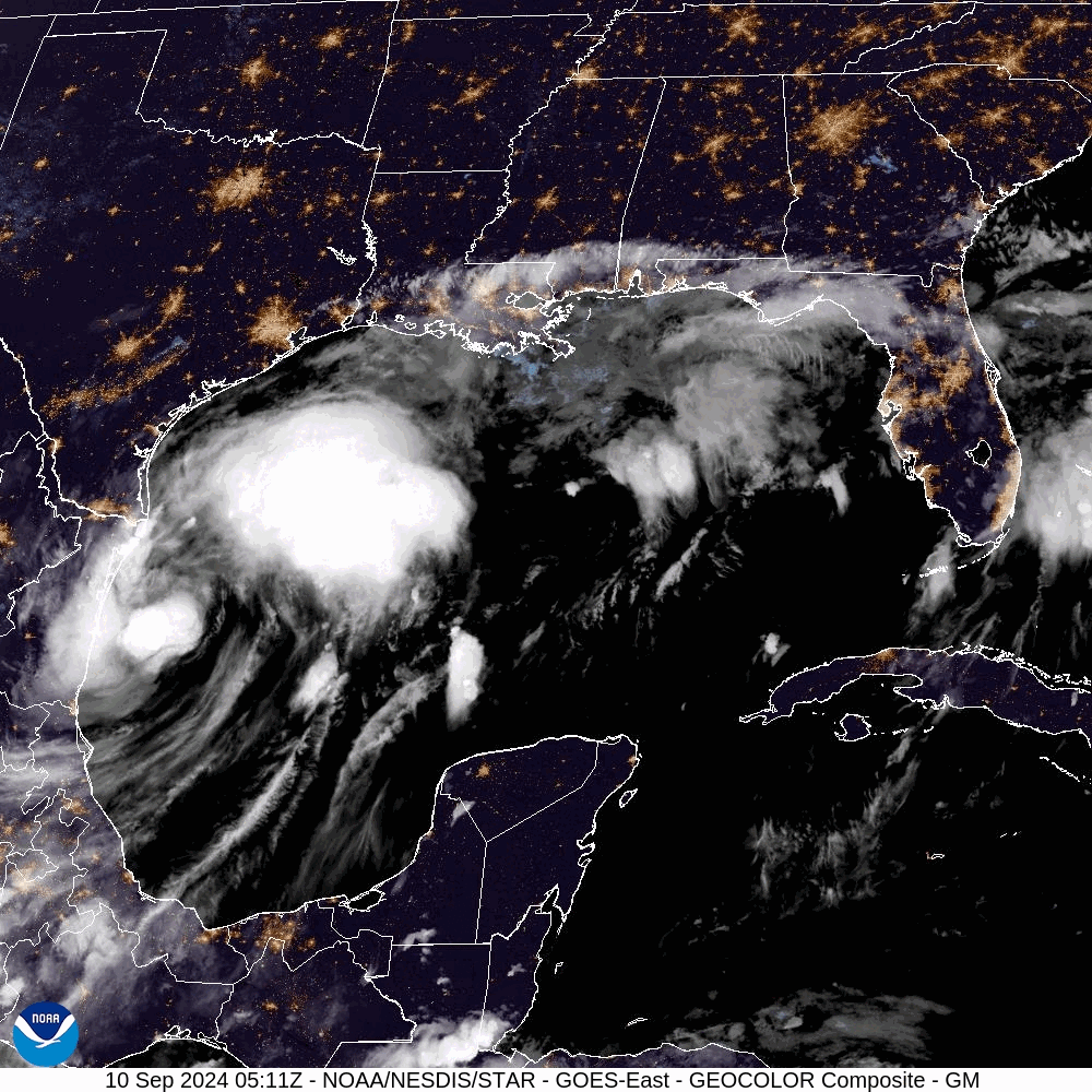
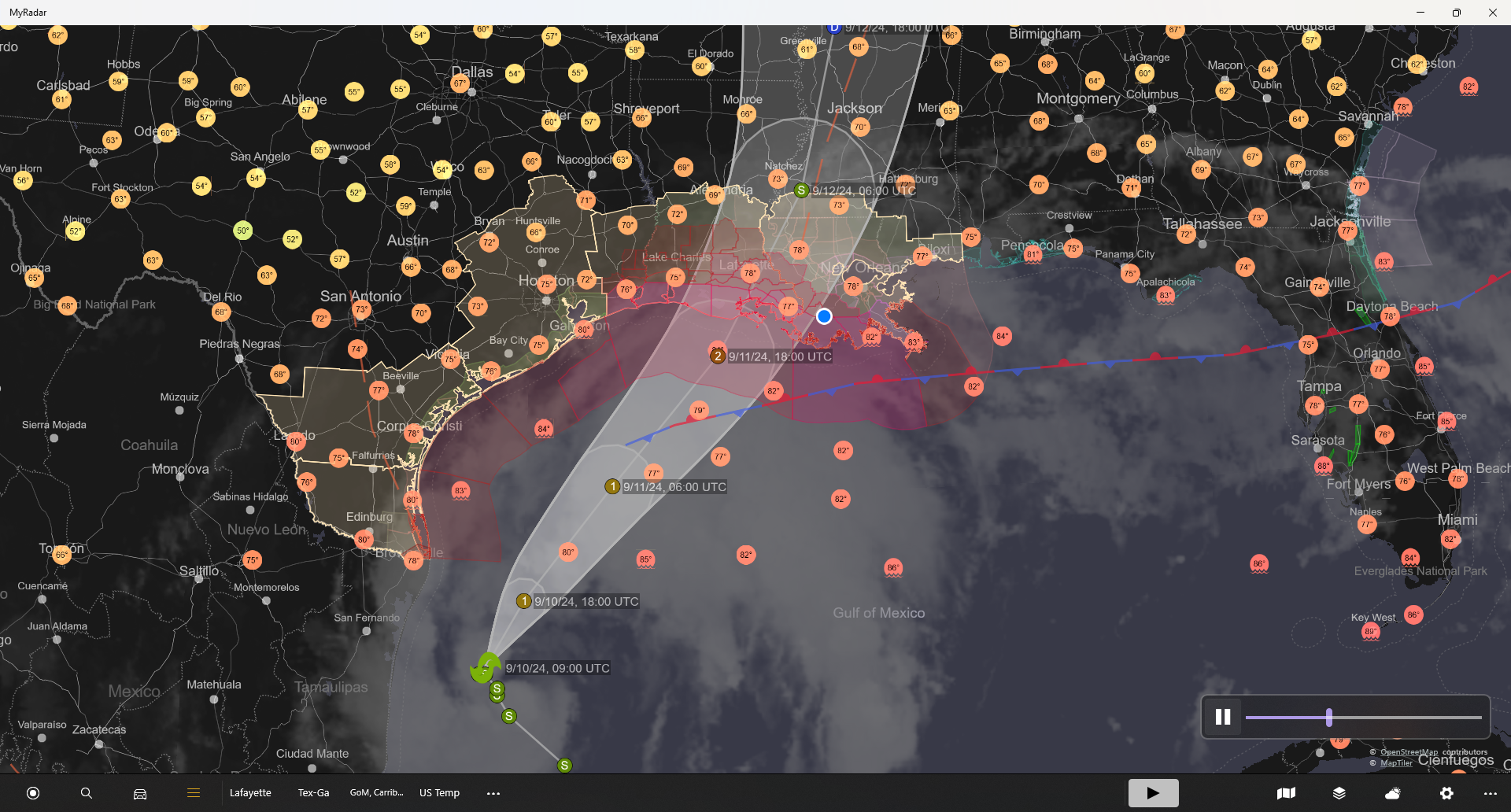
Tropical Storm Francine is currently moving about 5 mph NNW with a pressure of about 992 mb. Sustained winds are 65 mph. She is about 415 miles SSW of Cameron, Louisiana. The math says if she continues at this speed, she won’t make it here until Friday. But, the official forecast has her accelerating and making landfall after 1 pm Wednesday with 100 mph winds between Pecan Island and Marsh Island (SSW of Lafayette). However there is disagreement in the data about the arrival time. Some are pushing landfall to late Wednesday evening. I would not be surprised if today there weren’t significant adjustments to the official forecast. The discussions seem to be at odds with themselves.
The 100 mph wind will be severe, causing considerable damage to compromised housing. As witnessed in Terrebonne and Cameron Parishes in the recent past, tin roofs and tall buildings will reap most of Francine’s Fury. If you live in one of these structures, take appropriate action to protect yourself.
Tuesday is the day to evacuate. The storm may not be formed at the current time. However, there will be rapid intensification to at least a category 2 storm. At which time, the storm will be too close to travel without considerable weather against you.
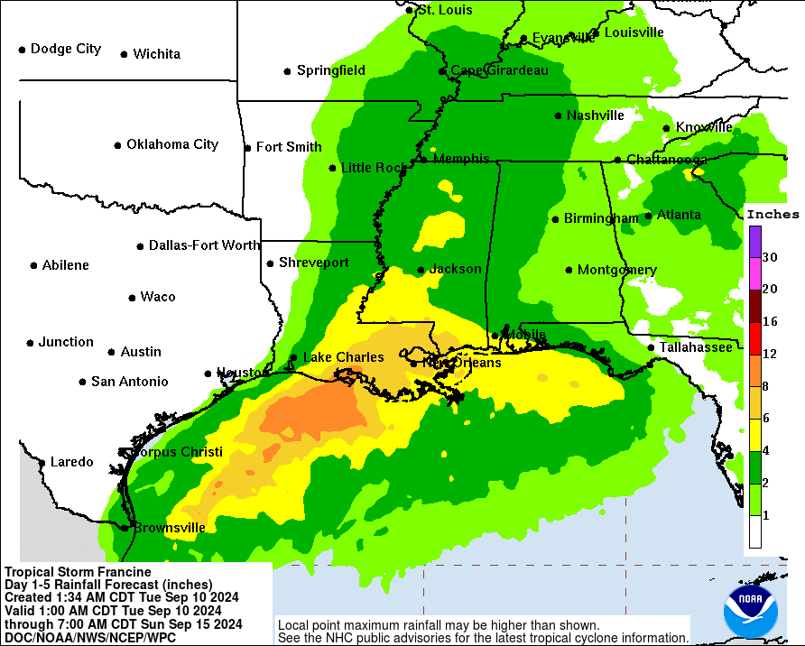
The Gulf Coast of Louisiana should begin feeling tropical storm force winds between 2 and 8 am Wednesday morning. Francine should produce about 8 inches of rain along the coast.
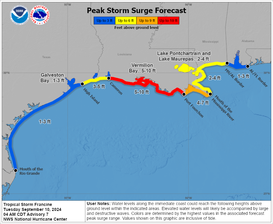
There is a storm-surge warning from High Island, Texas to the mouth of the Mississippi. There is an expected 5-10 ft. surge from Cameron to Port Fourchon with lesser surges elsewhere.
Godspeed,
Jazzy J
Wind field and potential track
Buoy information available by selecting desired buoy – data is real-time.
Frontal systems forecast for the next 24-hours for addition front projections see page Fronts.