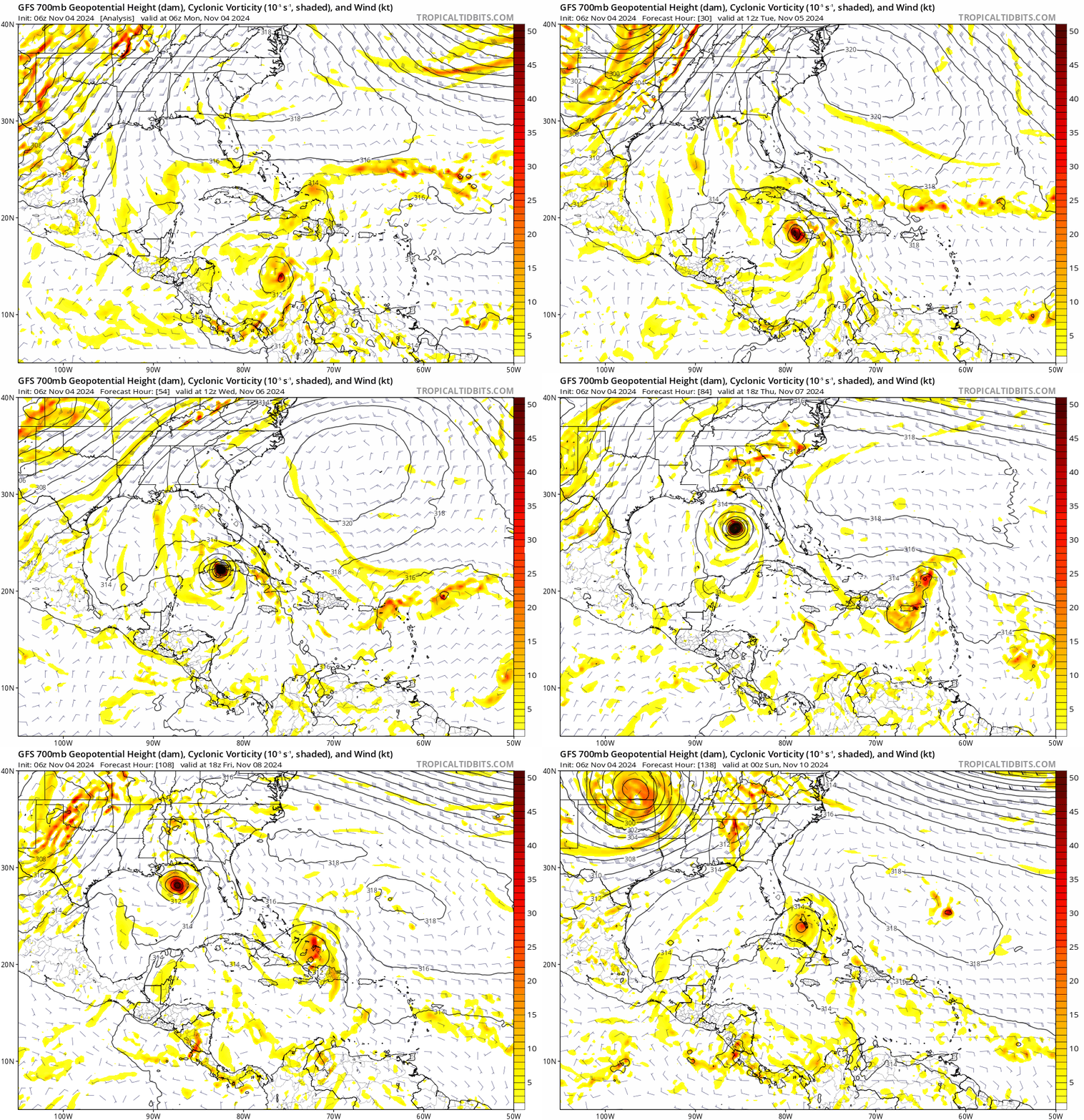
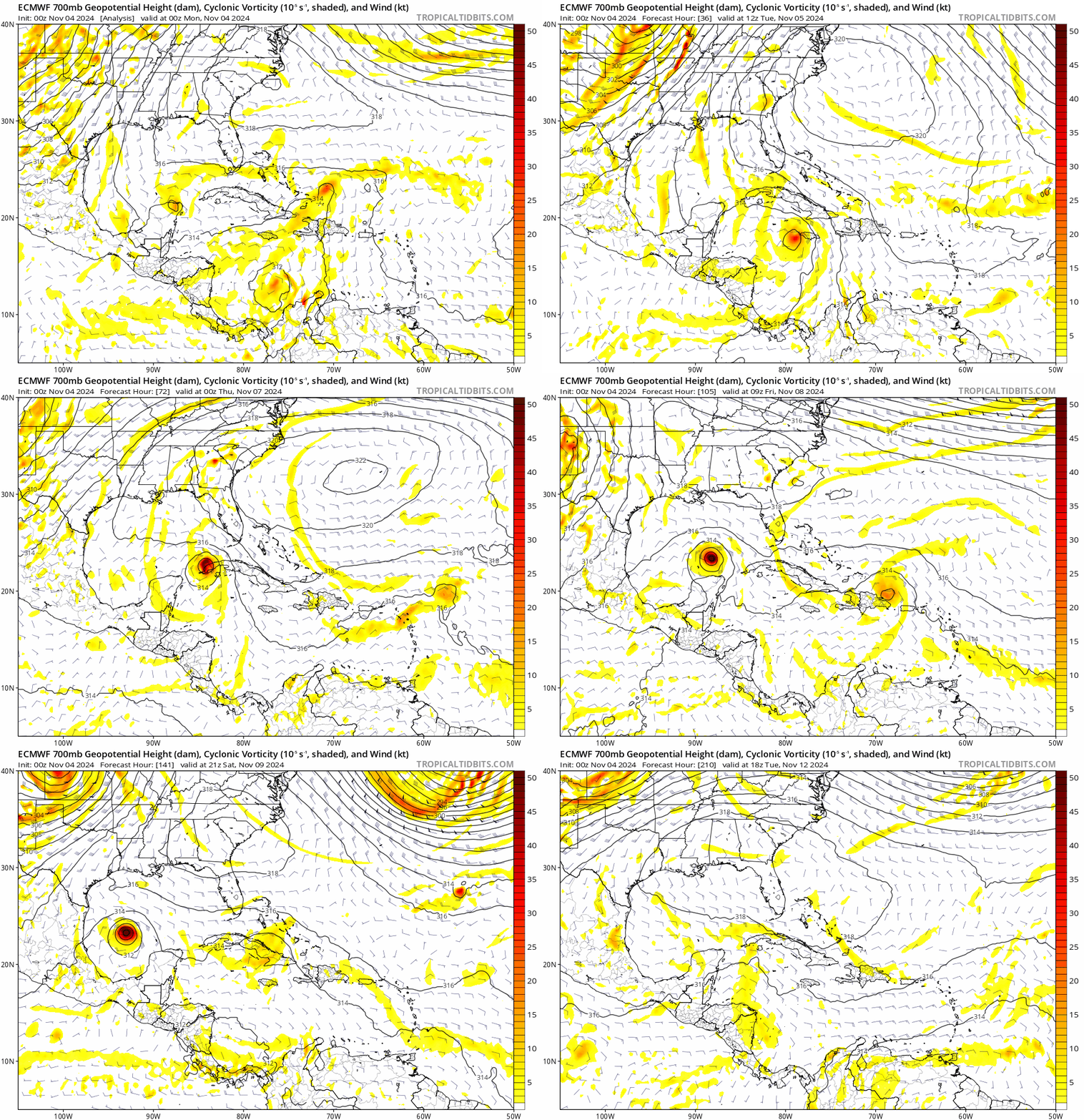
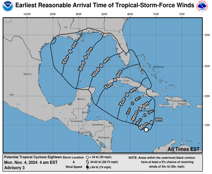
There seem to be a bid of disagreement of the path and definite disagreement with the strength. There is a lot of shear in the Northern Gulf of Mexico which could cause the storm to dissipate as it approaches the Northern Gulf coast. However, this depends on what it does when it approaches the central Gulf. In all, I think this one may be one we need to pay attention to. As its future is not certain, we may have little time to make decisions and take precautions.
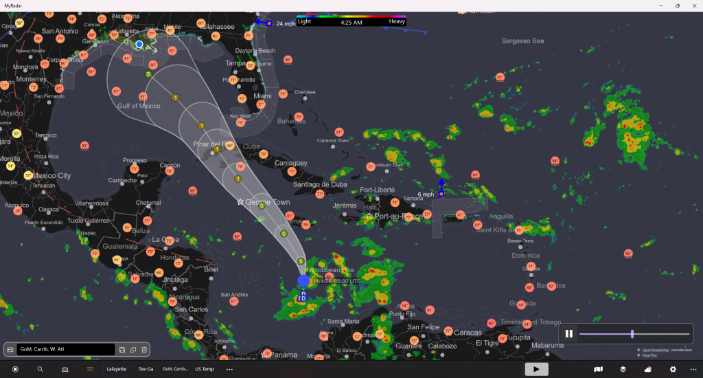
As of now, we can expect the arrival of tropical force winds Thursday morning around 8 am.
nhc.noaa.gov
000
WTNT43 KNHC 040850
TCDAT3

Potential Tropical Cyclone Eighteen Discussion Number   3
NWS National Hurricane Center Miami FL       AL182024
400 AM EST Mon Nov 04 2024

The system's deep convection is gradually becoming better organized
with a little more concentration of the shower and thunderstorm
activity.  However, convective banding features are not yet well
defined, and observations from an Air Force Hurricane aircraft did
not show a distinct circulation center.  Surface observations and
scatterometer data indicate very light winds over the western
portion of the disturbance.  Since the circulation has yet to
become well defined, the system is still being designated as a
potential tropical cyclone at this time.  The current intensity
estimate remains at 30 kt based on the scatterometer winds and the
aircraft observations.  Another Air Force plane is scheduled to
investigate the system later this morning.

Given the lack of a well-defined center, the initial motion is
rather uncertain.  My best estimate is slowly northward, or 360/6
kt.  Over the next few days, the system should move generally
northwestward on the southwestern periphery of a mid-level high
pressure system near and east of the Florida peninsula.  Later in
the forecast period, the track guidance diverges significantly,
with the latest ECMWF and U.K. Met office model predictions well to
the southwest of most of the other guidance tracks.  The motion
during the latter part of the period is partially dependent on how
much the mid-level subtropical ridge to the northeast is eroded by
the upstream flow and how strong and vertically deep the tropical
cyclone will become.  The details of this evolution are not well
known at this time.  In any event it should be noted that, given the
uncertainty in the center location, there is greater than usual
uncertainty in the track forecast.

As noted earlier, there is also significant uncertainty in the
intensity prediction.  For the next 48 hours or so, the system
will be traversing waters of high oceanic heat content with low
vertical wind shear.  Therefore strengthening is likely, but the
amount of intensification is largely dependent on whether a
well-defined inner core and vertically aligned circulation
develops.  If this evolution occurs, which cannot be known with
great certainty, significant intensification is likely before the
system reaches Western Cuba.  Later, the environment over the Gulf
of Mexico should be less conducive for strengthening with strong
southwesterly shear and drier air.  The official intensity
forecast lies between the more conservative statistical-dynamical
guidance and the more aggressive regional hurricane models.


Key Messages:

1. The disturbance is expected to become a tropical storm today and
pass near Jamaica on tonight and Tuesday where a Tropical Storm
Warning is in effect.  The system is forecast to become a hurricane
by Tuesday night and there is a risk of dangerous impacts from
hurricane-force winds and storm surge in the Cayman Islands and
portions of western Cuba.

2. Interests in Cuba and the Florida Keys should closely monitor
this system as hurricane and tropical storm watches could be
required for portions of these areas later today.

3. The system is forecast to enter the western Gulf of Mexico later
this week, but given significant uncertainties in the long-range
forecast track and intensity, it is too soon to determine what, if
any, impacts could occur.  Residents in this area should regularly
monitor updates to the forecast.

4. The system will bring areas of heavy rain across portions of the
Western Caribbean, including the island of Jamaica and portions of
Cuba through mid-week. Flooding could occur over portions of Jamaica
and Cuba, with mudslides possible.  Heavy rainfall would then
spread north into Florida and adjacent areas of the Southeast United
States mid to late week.


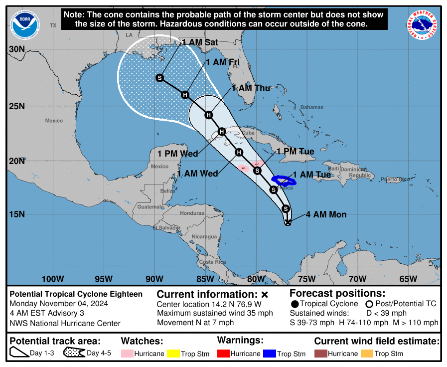
FORECAST POSITIONS AND MAX WINDS

INIT  04/0900Z 14.2N  76.9W   30 KT  35 MPH...POTENTIAL TROP CYCLONE
 12H  04/1800Z 15.5N  77.1W   35 KT  40 MPH...TROPICAL CYCLONE
 24H  05/0600Z 17.3N  78.3W   45 KT  50 MPH
 36H  05/1800Z 19.1N  79.9W   60 KT  70 MPH
 48H  06/0600Z 20.8N  81.7W   70 KT  80 MPH
 60H  06/1800Z 22.7N  83.4W   70 KT  80 MPH...INLAND
 72H  07/0600Z 24.2N  84.7W   70 KT  80 MPH...OVER WATER
 96H  08/0600Z 26.0N  87.0W   65 KT  75 MPH
120H  09/0600Z 27.5N  89.5W   55 KT  65 MPH

$$
Forecaster Pasch
