
-
Sept. 11, 2024, 5 am. Francine making landfall as a cat. 2
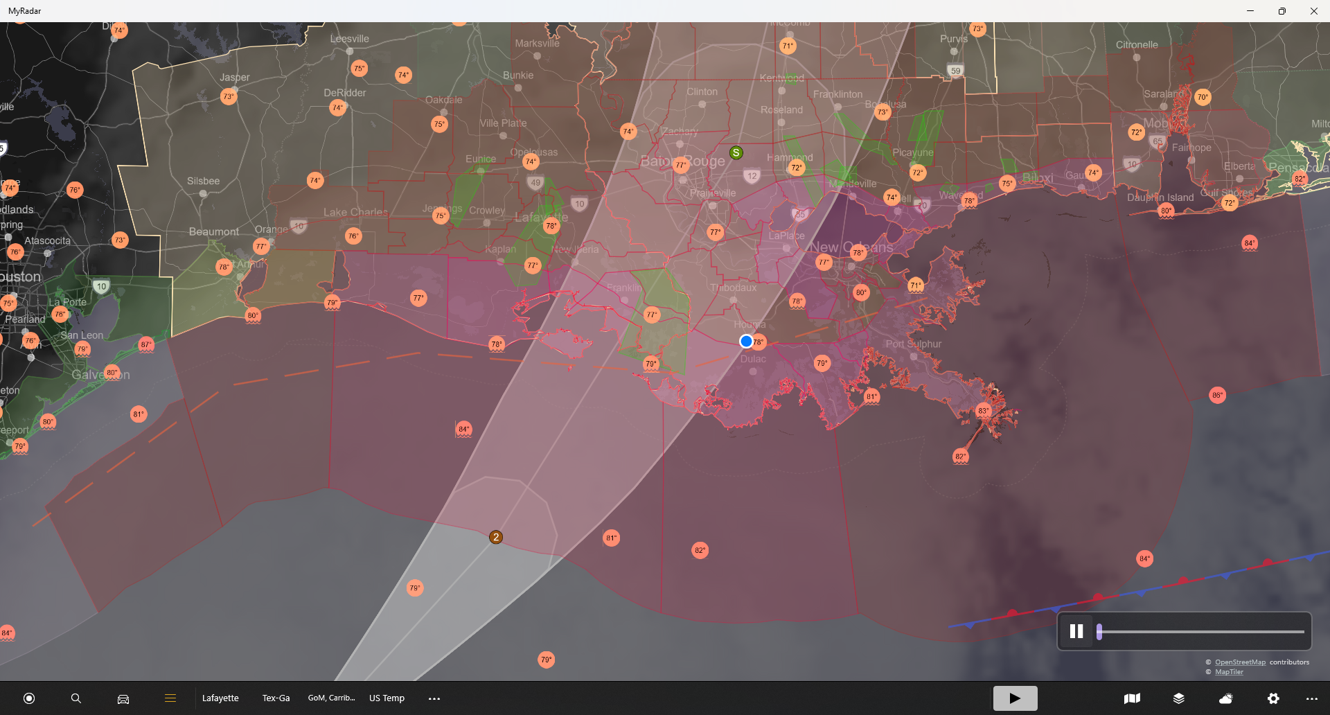
Landfall about 5-7 pm. But, coastal areas feeling tropical storm winds as early as noon. Center pressure estimated at 977 mb. However, Hurricane Hunters are thinking they may find the central pressure even lower. Storm surge can be significant from Atchafalaya to Cocodrie. Estimated to be 5-10 feet with 70 mph winds. If you live…
-
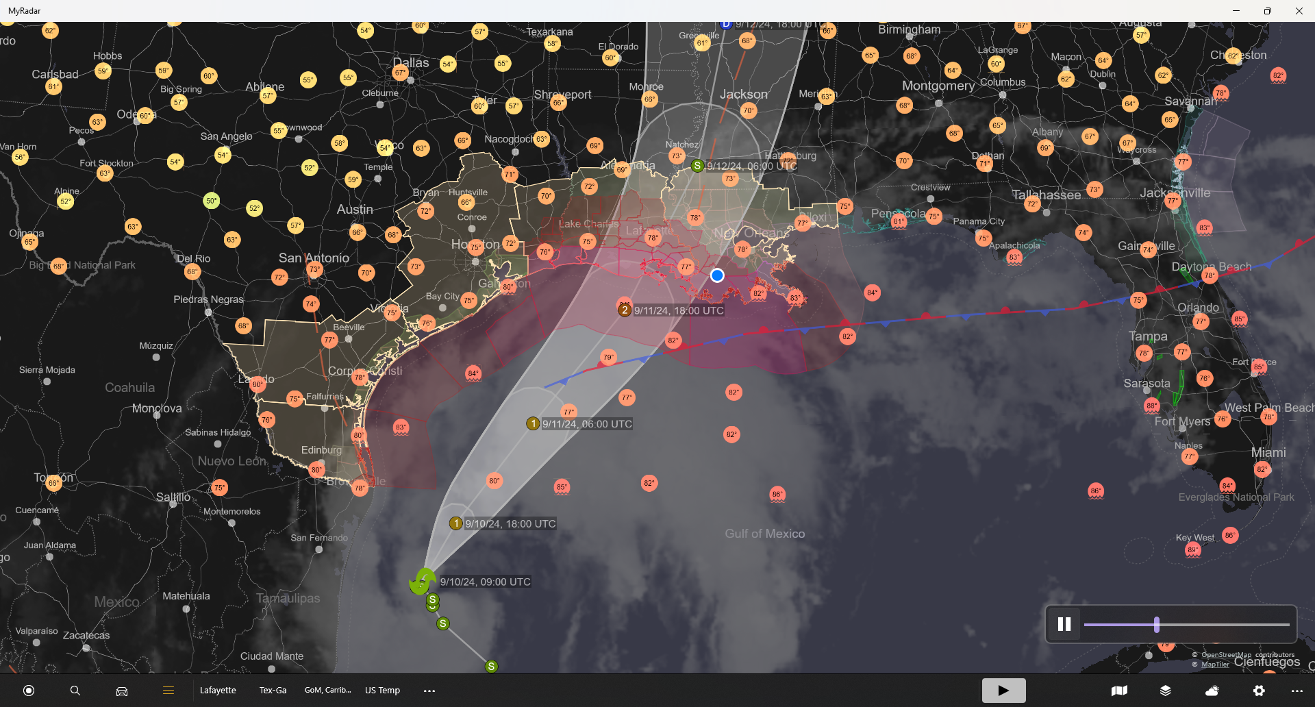
9/10/24 – Francine Track Correction
Track Correction to just west of Morgan City. Projected strength is now a Category 1. This is good for Lafayette, bad for St. Mary and Terrebonne Parishes. If you are in a compromised or weak structure, you need to take action today (Tuesday) not Wednesday. Wednesday will be too late to make preparations as we…
-
Sept. 10, 2024, TS Francine, Preparing for a Cat 2
Tropical Storm Francine is currently moving about 5 mph NNW with a pressure of about 992 mb. Sustained winds are 65 mph. She is about 415 miles SSW of Cameron, Louisiana. The math says if she continues at this speed, she won’t make it here until Friday. But, the official forecast has her accelerating and…
-
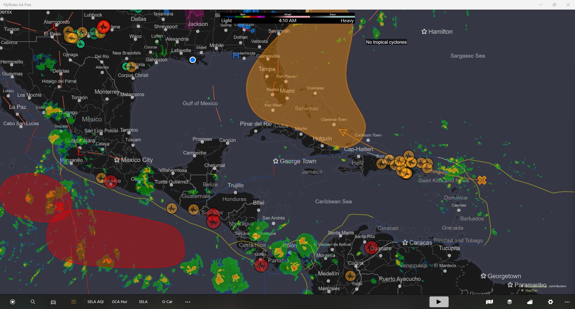
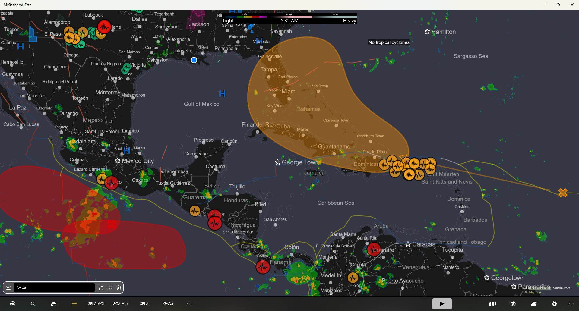
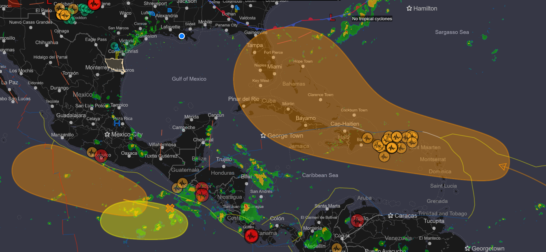
Sept. 1, 2024
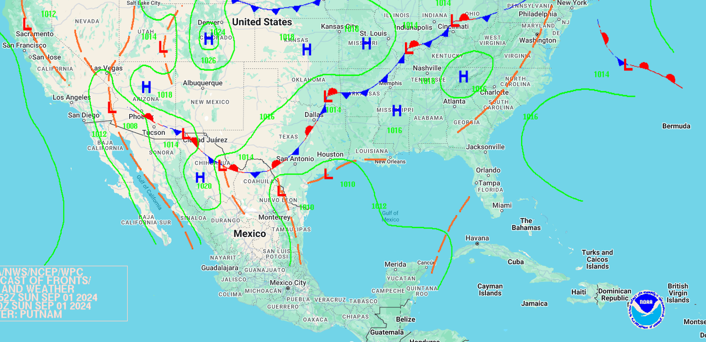
Not much threatening now, but stuff to watch. Potential flooding due to rain along the coast. We need to be observant of possible development in the Caribbean in the next week. Then the following week, the Gulf could be threatened by “Francine” should the orange swath develop.
-
Aug. 4, 2024
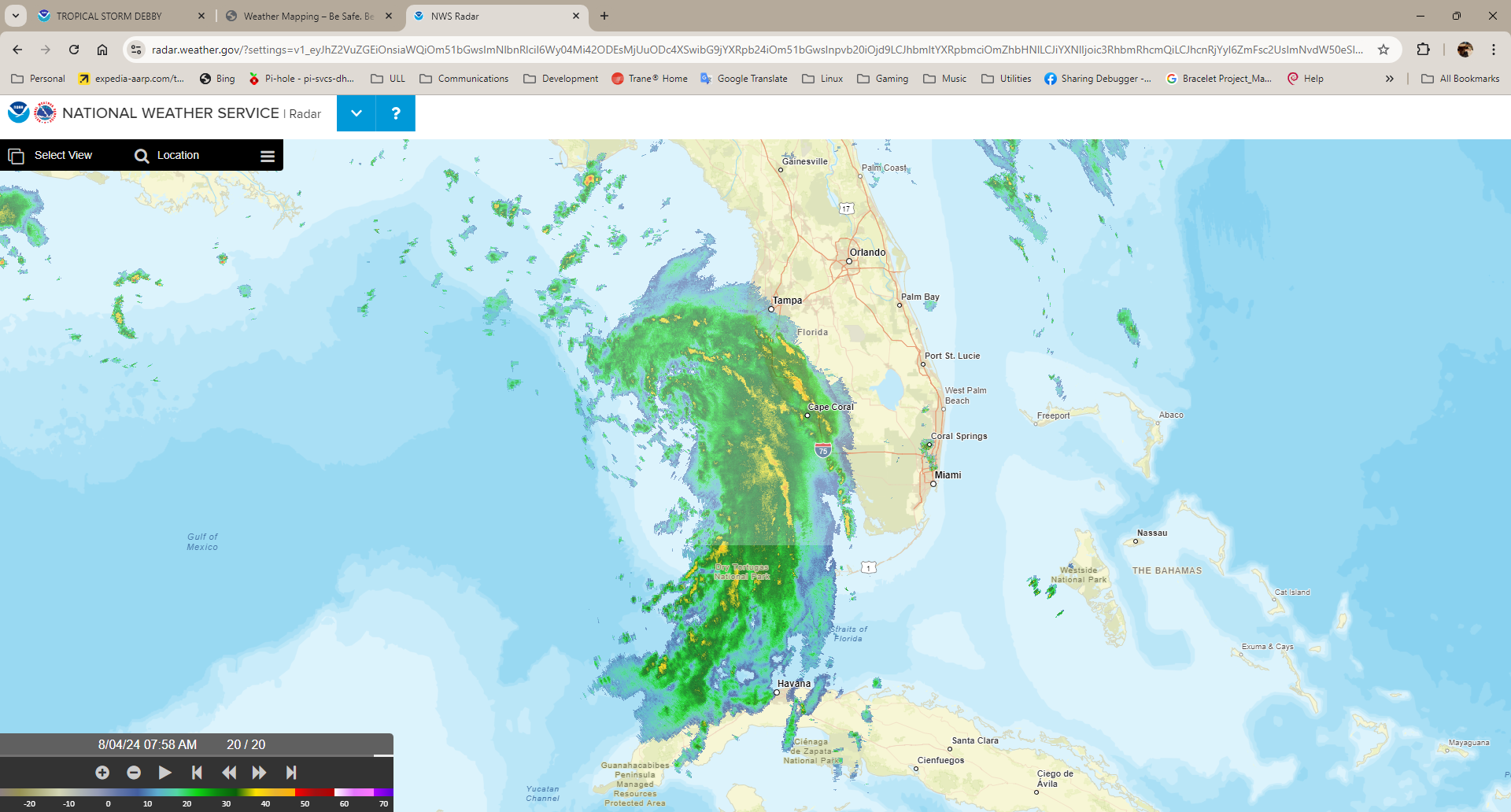
Maximum sustained winds have increased to near 60 mph (95 km/h) with higher gusts. Continued strengthening is forecast, and Debby is expected to become a hurricane by tonight before it reaches the Florida Big Bend coast. Weakening is expected on Monday and Tuesday after Debby moves inland
-
Aug. 1, 2024
-
Aug. 2, 2024
-
July 31, 2024
Not much changed except a weird distorted field of probability. This storm is expected to coalesce this weekend and max out at a tropical depression. Most likely it will become a rain maker for the Bahamas and/or Florida. There is a diminishing chance it will pose issues for the eastern Gulf coast.
-
July 30, 2024
Track dependent upon interaction of system with high pressure systems and islands. A slow storm could threaten the eastern Gulf of Mexico, where a faster storm could skim the eastern coast of Florida.
-
July 28, 2024
40% development in the next 7 days. Potential track recurves north, east of Florida.