Category: Ian
-
September 28, 2022, Ian 1 pm Update
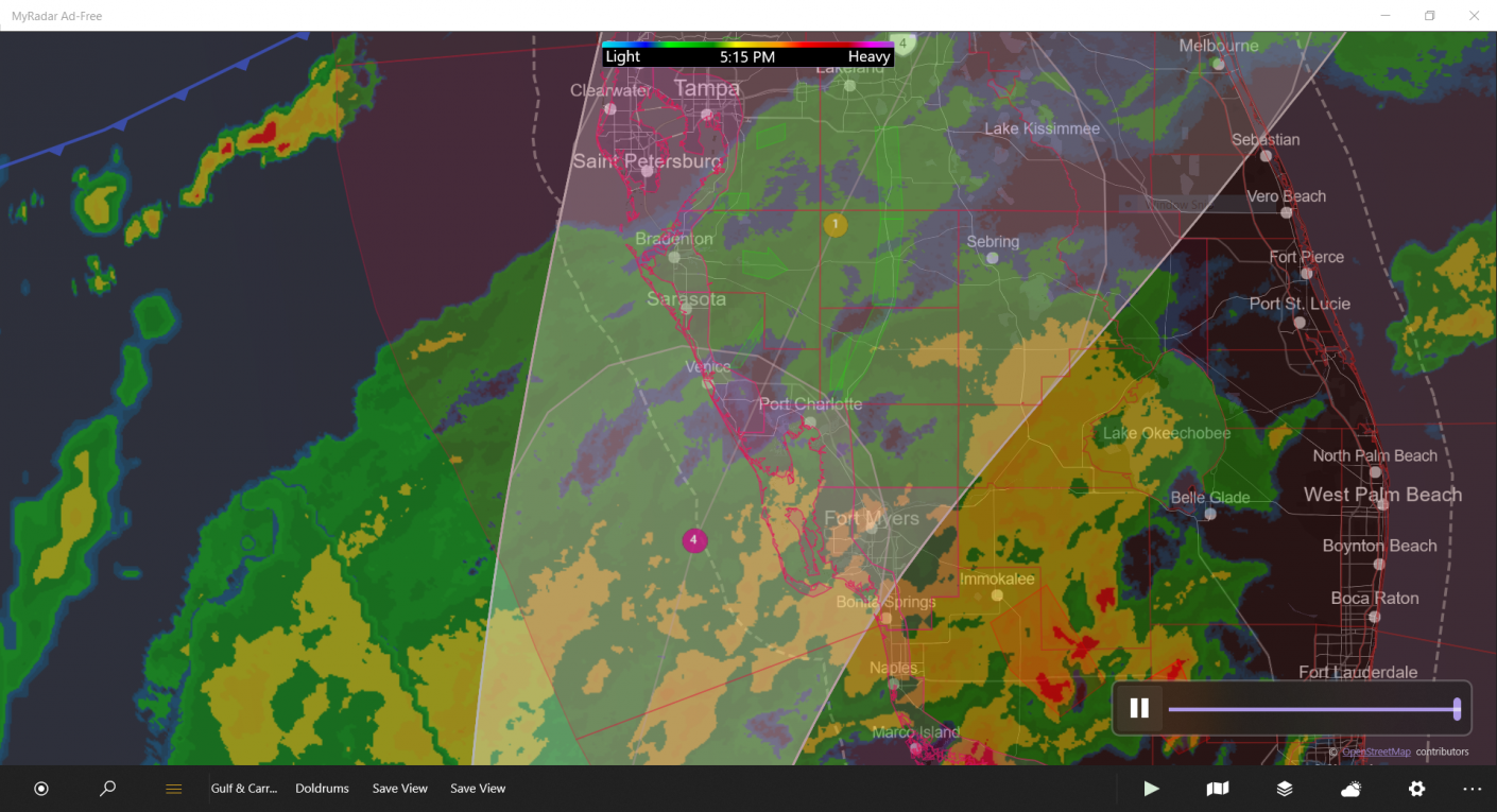
Catastrophic storm surge inundation of 12 to 18 feet above ground level along with destructive waves are expected somewhere along the southwest Florida coastline from Englewood to Bonita Beach, including Charlotte Harbor. Residents in these areas should urgently follow any evacuation orders in effect.
-
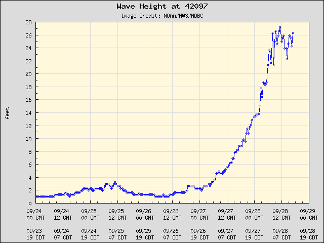
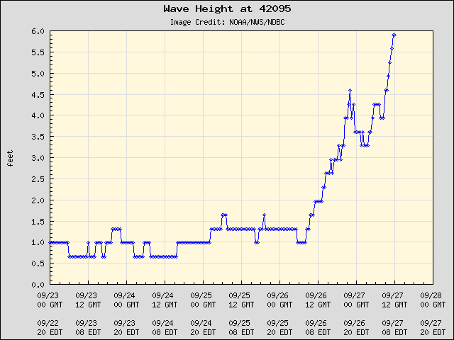
September 28, 2022 – Ian 5am EST Update
Overnight and currently, buoys off the west coast of Florida reported wave heights in excess of 26 feet. As a rule of thumb, divide wave-height by 2 to get an estimate of the storm surge coming on shore at low-lying areas not protected by flood-walls. Port Charlotte, existing at the tip of the funnel-shaped Harbor…
-
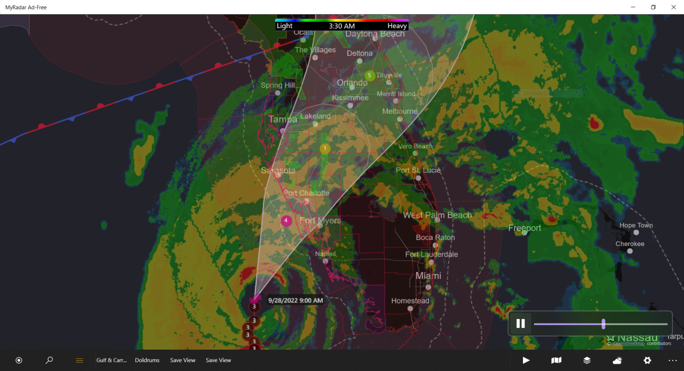
September 27, 2022 – Ian Interim update
Devastating tidal surge forecast for Port Charlotte. Residents be advised and take appropriate action following your local governments advice.
-
September 27th, morning
WATCHES AND WARNINGS ——————– CHANGES WITH THIS ADVISORY: None SUMMARY OF WATCHES AND WARNINGS IN EFFECT: A Hurricane Warning is in effect for… * Cuban provinces of Isla de Juventud, Pinar del Rio, and Artemisa * Bonita Beach to the Anclote River, including Tampa Bay * Dry Tortugas A Storm Surge Warning is in effect…