Category: R & D
-
Coastal Land-Based Weather Station Selection
Below is a map, with a bunch of boxes and the coordinates of their Southwest and Northeast corners. These are going to be the areas of greatest focus for land-based weather stations. GOMandCarib: sw – 5,-103, ne – 33,-44 EastUSAtlantic:30,-83;41,-68 WestUSAPacific: 33,-127; 45,-114 BajaCalif: 17,-123; 35,-100 [Google_Maps_WD id=80 map=55]
-
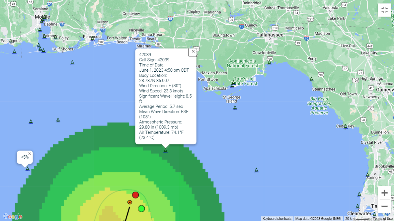
False representations of data
Representation of Storm 2, 2023, shortly before named Arlene.
-

NHC Updates Forecasting for 2023
This is the most significant news blurb of this century and there ain’t much there. The short of it is the National Hurricane Center (NHC) is extending its tropical forecasting from five to seven days. They have been examining their data on forecasts vs. accuracy since 2019 and have decided they are accurate enough to…
-
CWAADS’s data collection ACTIVE!!!
In the previous 48 hours, I was able to code the scraping routines for CWAADS (Coastal Weather Anomaly Advance Detection System). I had a few tweaks to perform in transitioning it from manual triggering to a CRON trigger. Mainly, I incorrectly assumed that CRON would recognize the path to PHP and it didn’t. Once I…
-
Moving forward on C.W.A.A.D.S.
The Coastal Weather Anomaly Advance Detection System (C.W.A.A.D.S), is progressing. It is currently able to automatically scrape all the real-time data available from the Nation Data Buoy Center (N.D.B.C.) for over a thousand weather buoys around the globe. See thought process and sample code with examples here (link will open in new tab or window).…