Year: 2021
-

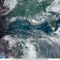
June 16th, 2021 – Morning Update
There aren’t many differences from yesterday to this morning. NOAA is expecting the disturbance to be named on Friday. The pathway is the same: meandering up the coast until it becomes an issue for the northern GoM coast on late Thursday or overnight into Friday. No solid information on intensification forecast. The weak high pressure…
-
June 15th, Morning Outlook
The weather map looks terrible, but things don’t seem to be that bad. For one, there is a weak high pressure system hanging out in the central GoM until “Mid-Week,” according to NOAA. I understand that tomorrow is “hump day” and thus, mid-week. But, if you look at the satellite imagery the central portion of…
-

Bay of Campeche Disturbance
Basically, it’s too early to tell. The consensus is to check back on Wednesday. There is an area of weak high pressure in the central portion of the Gulf preventing rapid development. However, living in SELA, we don’t need rapid development to find ourselves in trouble. My recommendation is not to freak out, but just…
-
GoM Buoy Data Feeds – All 178 of them – updates scripted
Success! Weather.jayctheriot.com was able to script the retrieval of weather information from 178 different buoys in the Gulf of Mexico (GoM) along the coast from the Texas-Mexico border to the Florida Keys. I still have the East, West and Hawaiian coasts, but that’ll be in the days forthcoming. You can see it here: GoM Buoy Data…
-
South Louisiana Weather Map
The purpose of this map is to help with analyzing the weather as it approaches from the West. The map is not completed at this time. More stations will be added. Additionally, I would like to incorporate data from the National Data Buoy service. Living on a coastal wetland, often weather data from the buoys…