Category: Cristobal
-
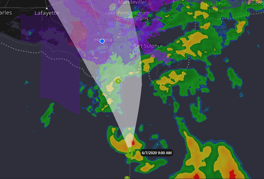
Cristobal, June 7th, Landfall Imminent
The projected path of the storm has changed very little over the last 24 hours, and landfall at Dulac/Cocodrie is imminent. By the time you read this, Cristobal could be on land. With the forward movement of the storm, the storm surge will not be as severe as it could be, but areas outside levy…
-
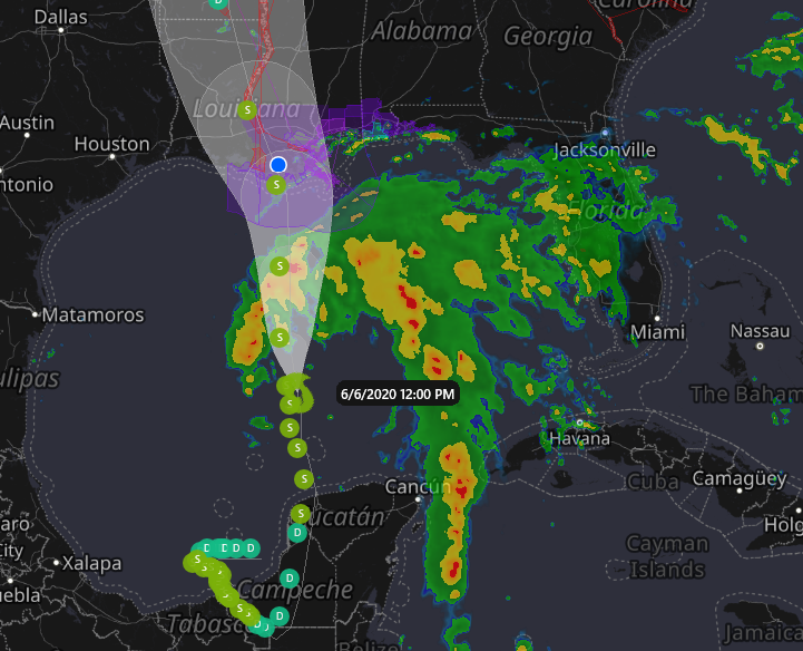
Cristobal 2020, Sat. June 6, Morning, Projected Path
Please, forgive the rudimentary nature of the tracking map, I’m trying something new. Looks like Cristobal is going to be paying us a visit. Landfall is projected to be at Cocodrie, LA, about 11 am, Sunday, June 7, 2020, with winds of 60 mph. FORECAST POSITIONS AND MAX WINDSINIT 06/0900Z 23.8N 90.2W 40 KT 45…
-
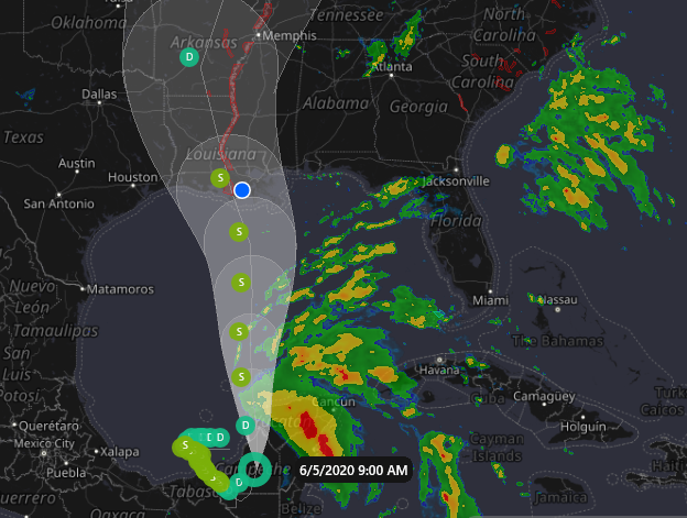
Cristobal, June 5, 2020 – Projected Landfall – Morgan City – 60 mph – 1 am Monday
My eyes are now focused on this storm. If you have interests in the Bayou Region of Southeast Louisiana outside the Morganza Levy system, you should too. The key indicator for areas east of the storm will be the rate of travel. Currently the storm is over land and will be for several more hours.…
-
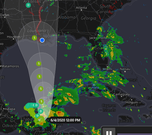
Cristobal – June 4, 2020, Morning
I think the largest concern with Cristobal examining the information currently available, will be from coastal flooding. All the forecasters are talking about flooding not an issue. IMHO, they are focused on non-coastal lands. St. Mary, Terrebonne, Lafourche and Plaquemines parishes should watch for the storm surge. I don’t believe it should be a major…
-
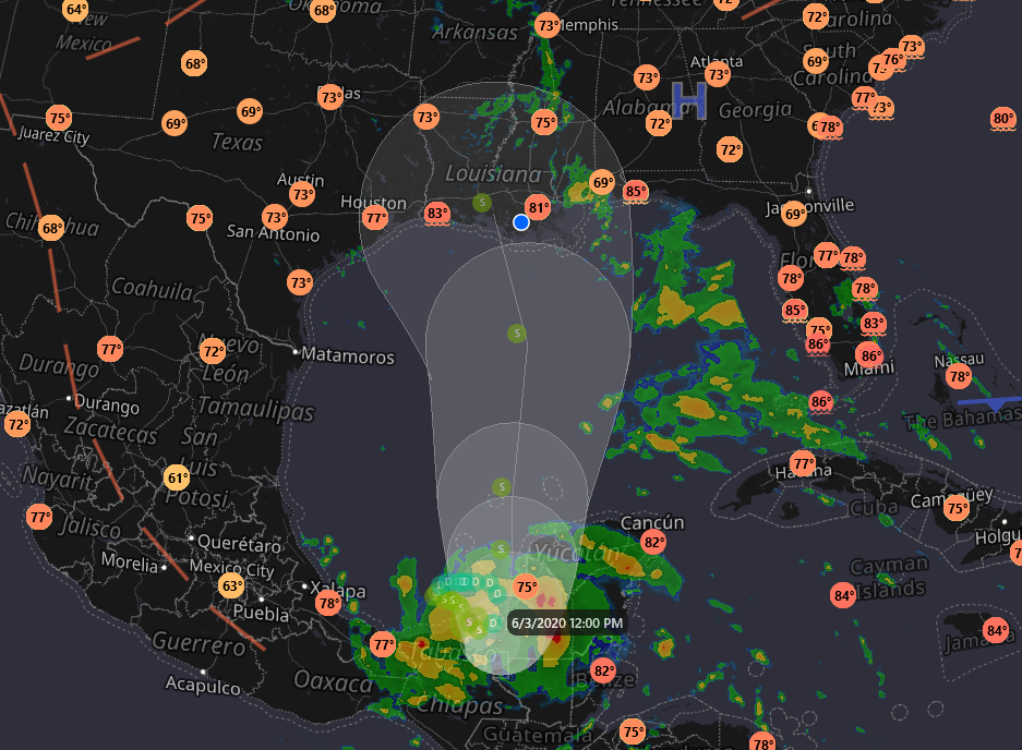
Tropical Storm Cristobal Intermediate Advisory Number 7A
BULLETIN Tropical Storm Cristobal Intermediate Advisory Number 7A NWS National Hurricane Center Miami FL AL032020 700 AM CDT Wed Jun 03 2020…CRISTOBAL ABOUT TO MAKE LANDFALL ON THE COAST OF MEXICO… …HEAVY RAINFALL AND LIFE-THREATENING FLOODING THREAT CONTINUES…SUMMARY OF 700 AM CDT…1200 UTC…INFORMATION ———————————————- LOCATION…18.8N 92.1W ABOUT 25 MI…40 KM NW OF CIUDAD DEL CARMEN…