
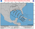
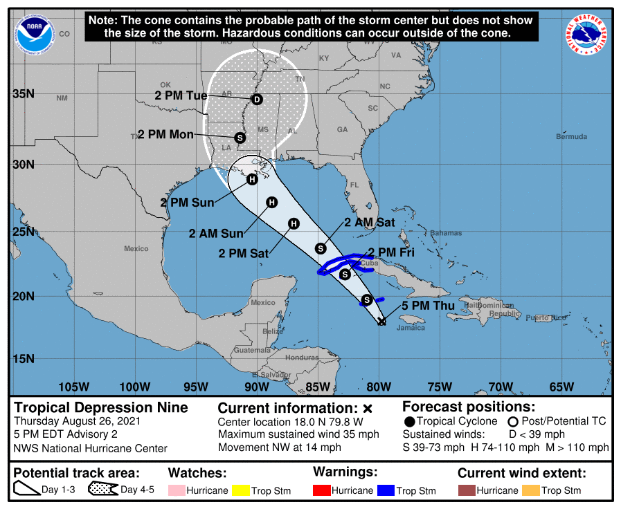
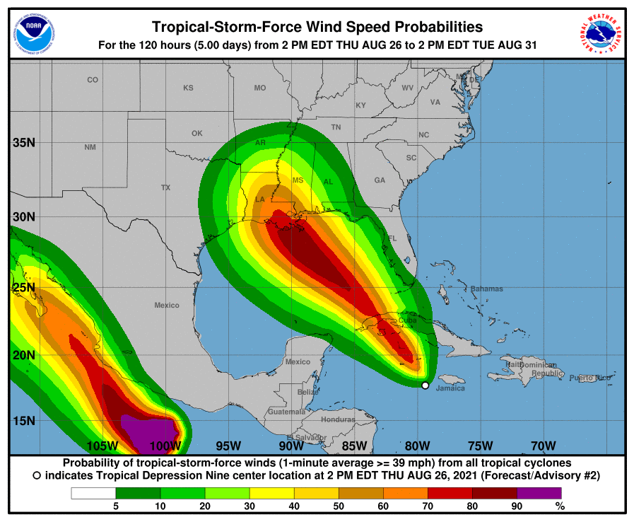
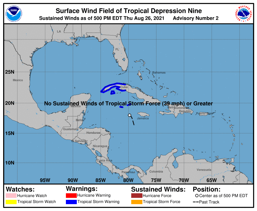
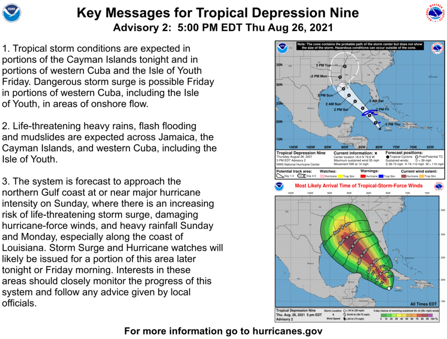
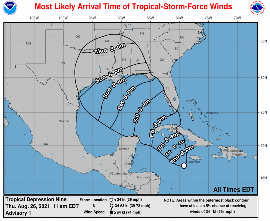
Click on the link to access the most current information and contents. Updates are posted shortly after they are released at 4 and 10 am/pm for the duration of the storm. I will be tracking and analyzing 2021 Ida as it approaches using some methods I’ve been working on. The tracks from the NHC have been refined over the years to have very little error. However, using surface-based data from buoys and airports, it is possible to increase the accuracy of the winds, strength, storm surge and overall ferocity of the storm. This analysis is still in development and the products created will not be the quality I wish, but they will be refined over time. Follow this page for updates, and as previously stated, don’t just scroll on FB or other social media. You have to click on the link to access recent information as FB takes a snapshot and only renders that once, missing the current information.
The following information is from Page 28, of the 2019 TPCG Emergency Guide (link) available at the Terrebonne Office of Emergency Preparedness website (link).
| PHASED EVACUATION | During a threat of a hurricane, a phased evacuation will be based on geographic location and time in which tropical storm winds are forecasted to reach the affected areas. |
| PHASE I | 50 Hours before onset of tropical storm winds. Includes areas south of the Intracoastal Waterway. These areas are outside any levee protection system and are vulnerable to Category 1 and 2 storms. During Phase I, there are no route restrictions. |
| PHASE II | 40 Hours before onset of tropical storm winds. Includes areas south of the Mississippi River which are levee protected but remain vulnerable to Category 2 or higher storms. During Phase II, there are no route restrictions. |
| PHASE III | 30 Hours before onset of tropical storm winds. Includes areas on the East Bank of the Mississippi River in the New Orleans Metropolitan Area which are within levee protection system but remain vulnerable to a slow-moving Category 3 or any Category 4 or 5 storm. During Phase III, certain routes will be directed and the Contraflow Plan implemented |